|
|
|||||||||||||
|
|
||||||||||||
|
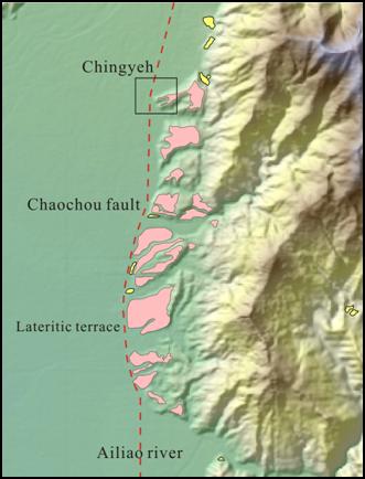
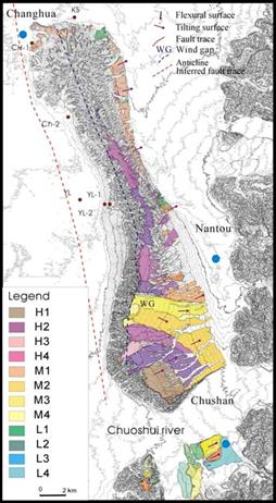
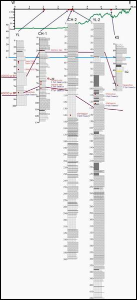
1, Regional Geology The Changhua fault is a frontal thrust fault in the central Taiwan that formed most recently. The topographic and stratigraphic features of the Pakua tableland (Pakuashan anticline) are similar to the Tatu tableland forming by a ramp structure (Figure 1). Suppe (1986) advocated that the Changhua fault is a fault-propagation fault. Based on the aerial photo and DTM data, the Pakua tableland is divided into 12 level terraces, mainly distributed in the south and the east sides of the tableland (Figure 1). The topmost level of H1 terrace represents the originally depositional surface of the Toukoshan Formation of the Pakua tableland. The other level terraces formed during the uplift of the Pakua tableland. 2, Fault Character Several core-boring on the hanging wall including Yuanlin, Changhua-1, and Kuosheng wells, the uplift rate is estimated at 0.8±0.1, 1.5±0.1, and 2.2±0.1mm/yr, respectively (Figures 2 and 3). And eight wells on the footwall, the subsidence rate is from 1.7±0.5 to 7.6±0.8 mm/yr. As a result, it is estimated that the vertical slip rate (maximum) of the Changhua fault is about 9.8±1.6mm/yr.
Figure 3, Vertical deformation rate on both sides of the Changhua fault. |
|||||||||||||